World-leading laser scanning technology
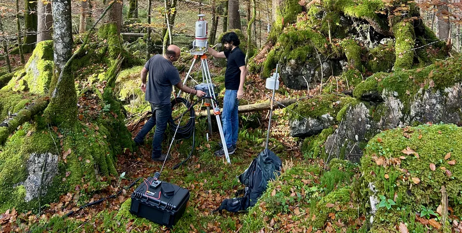
In our group we operate a Riegl VZ-400i terrestrial 3D laser scanning system, which offers data acquisition with up to 500,000 measurements/sec., a range of up to 800 m and an accuracy of 5 mm. The system enables the simultaneous acquisition of scan data and image data, as well as simultaneous georeferencing in real time. In addition to the scanner (including various accessories such as spare batteries, carrying systems and tripods), we have access to RiSCAN PRO, one of the leading software products for analyzing laser scanning data. RiSCAN PRO is project-oriented, i.e. all the data collected during a measurement campaign is organized and stored in the RiSCAN PRO project structure. This data includes scans, detail scans, digital images, GPS data, coordinates of control and connection points as well as all transformation matrices necessary to transform the data of several scans into a common coordinate system. Students and employees have the opportunity to run RiSCAN PRO on their computers for final theses and/or research projects. A high-performance workstation with GPU is available for demanding applications.
More information: http://www.riegl.com
Renting the scanner
In addition to a course for students on how to use laser scanners (see here), we offer the possibility of lending the device for final theses and research purposes. The prerequisite is instruction by us and proof of liability insurance. For better coordination, all scheduled dates are listed in the following calendar. If you are interested in using the laser scanner, please contact Andreas Hanzl.
More Info